Map Tooltip Configuration
Map Tooltip Configuration
Clicking directly on a map feature will open and Info Card, like this:
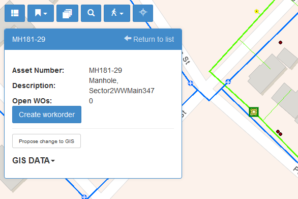
This card, or tooltip, is configurable, and can be defined for every MapEngine layer. In the AGMAPLAYERS table you’ll find a field called TTJSON. Every layer can have a JSON object stored in this field, containing the information about fields to display in the tooltip and where to find them.
This is the syntax you should use:
{“Display name”: “key|fieldname”, … }
There are 4 different types of keys that can be used—M, MS, G, and F.
M – Normal Maximo tables (e.g. WORKORDER, ASSET, LOCATIONS)
MS – Maximo Spec tables (e.g. WORKORDERSPEC, ASSETSPEC, LOCATIONSPEC)
G – GIS data
F – html from a JavaScript function – where the function must take parameters key1 and maxtype (A, L, W) and return the html to be put in the field value.
T – plain text. For example, “Type”:“T|Manhole” would display “Type: Manhole” in the tooltip
Fieldname specifies the name of the field in the table, or the function name.
Example JSON:
Here are a few examples of how to configure the tooltip. [BTW, an empty JSON object can be used to disable tooltips for the layer.]
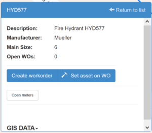
Tooltip with Maximo asset specifications:
{"Description":"M|DESCRIPTION", "Manufacturer":"MS|MANUFACT","Main Size":"MS|MAINSIZE","Open WOs":"F|agGetNumberOfOpenWOs",”Type”:”T|Manhole”}Looks like this:
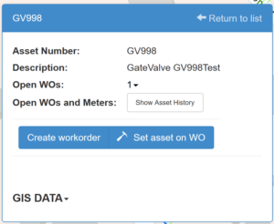
Tooltip on an asset with open work order count display:
{"Asset Number":"M|ASSETNUM","Description":"M|DESCRIPTION", "Open WOs":"F|agGetNumberOfOpenWOs", "Open PMs":"F|agGetNumberOfOpenPMs"}This looks like this:
Tooltip for a Service Request:
{"Ticket #":"M|TICKETID","Description":"M|DESCRIPTION","Status":"M|STATUS","Location":"M|LOCATION","Asset":"M|ASSETNUM","Report data":"M|REPORTDATE"}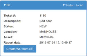
…looks like this: